
Recalculation of Point Cloud Coordinates
 Ribbon: Point Clouds – Point Cloud >
  Recalculation of Point Cloud Coordinates
Ribbon: Point Clouds – Point Cloud > Recalculation of Point Cloud Coordinates
 Command line: NPC_REPROJECTION
If the loaded point cloud has geocoordinates, the command allows you to recalculate them to another system. This creates a new cloud for the target coordinate system.
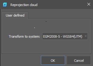
NOTE: The Recalculation of point cloud coordinates and Recalculation of point cloud coordinates by EPSG commands are mutually exclusive. Use one of them to convert geocoordinates of a cloud.
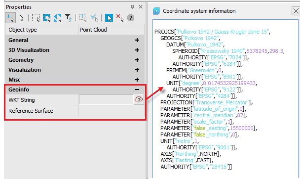
Information on the current geocoordinate system of the cloud can be viewed by clicking the button from the Properties bar (Geoinfo section) or from the Point cloud information dialog.
NOTE: After recalculation of geocoordinates to CS with the geoid reference surface, then the recalculation should be made back to the surface of the ellipsoid type, and only then to other projections (i.e., from the geoid, you shloud first return to the ellipsoid).
Feedback
Copyright © 2026 CSoft AS
—
Powered by 
Post your comment on this topic.