
 Ribbon: Point Clouds – Calculations and Info >
  Point Cloud Info
Menu: Point Clouds – Calculations and Info > About Cloud
Toolbar: Point Clouds > Point Cloud Info
Properties toolbar – Misc – Point cloud info >  button
 Command line: NPC_INFO
Displays statistic information about point cloud and excludes/includes certain point cloud attributes.
Tree Statistics
Displays cloud structures information.
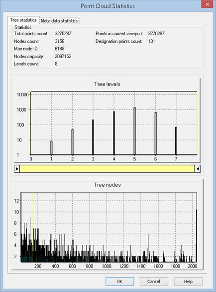
Statistics displays the number of points, nodes and levels, their maximum and designation.
Tree levels displays the distribution of nodes (vertical axis) in tree levels of structured cloud (horizontal axis). Use sliders to trim points of certain hierarchical structures.
Tree nodes displays the distribution of nodes in tree points of point cloud.
An example of point cloud with different levels:


Meta Data Statistics
Displays existing attributes of imported point cloud. Marked by flags.
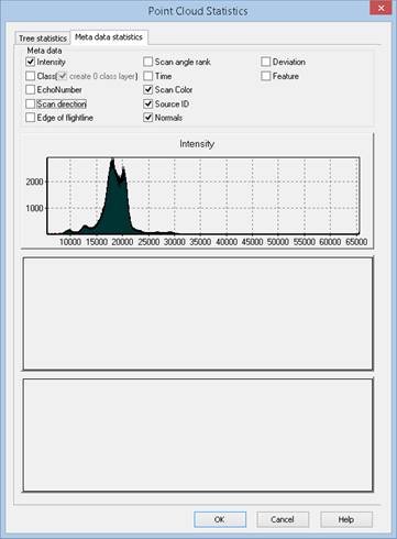
Remove flags to unload attributes from the cloud. All info on these attributes unloads from the current document. After attribute unloading all operations with these attributes are not available.
NOTE: Attributes unloaded only from the current document. External file with point cloud is unchanged.
Tick flags to create new attributes. Note: new attributes do not contain any values. For example: Unload Intensity attribute, then load it. Previous values will not be restored.
Meta data statistics displays also point cloud distribution by intensity, class and echo number. Diagram not displayed if the attribute is not exists.
If originally the cloud did not have Class attribute, enabling the create layer box will automatically create a new layer with the name Created, not classified (code 0) and assign class 0.to all cloud points.
This tab also displays diagrams of the cloud points distribution by such attributes as intensity, class and echo number. If the attribute is absent, the diagram is not displayed.
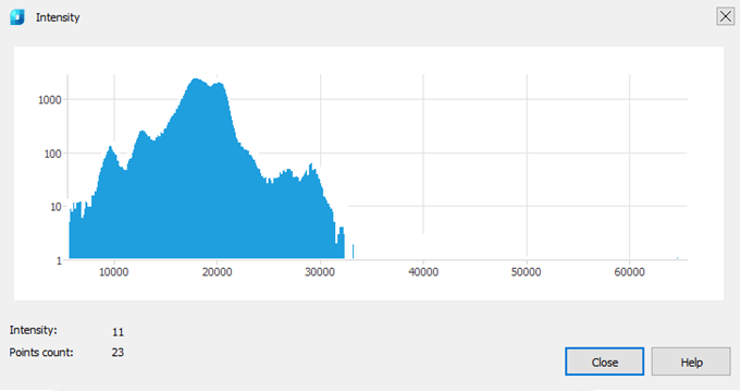
The
 button next to some attributes allows you to view the diagram of the distribution of the values of this attribute. This is possible for such attributes as Intensity, Class and Echo number. If there are no attribute values, the chart is not displayed.
Geoinformation
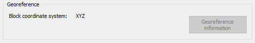
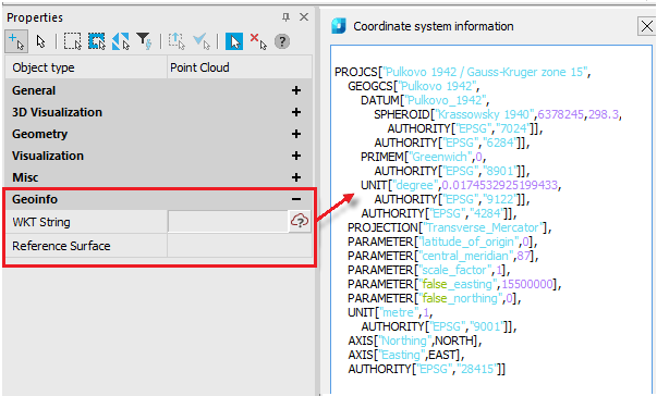
Point clouds imported from some types of formats (LAS, LAZ) can be geo-referenced. In the Georeference section, by clicking the Georeference information button, you can view detailed information about the coordinate system and georeference of the cloud.
The same information for the cloud selected in the workspace can be viewed in the Properties bar in the Geoinfo section.
Info: NanoCAD is a simple, low cost, and yet professional, CAD platform for personal computer, that delivers an outstanding user experience by providing high performance, full capability, a classic interface and native.dwg format support. nanoCAD has been built to deliver design and project documentation for all industries. nanoCAD includes a full suite of basic and advanced CAD tools for 2D/3D drawing and creating industry-standard DWG-compatible CAD files. Our tool provides groundbreaking, collaborative and customizable features to raise your efficiency, and includes a number of API’s, allowing anything from routine task automation to complex CAD software development. You may download nanoCad for free, using the links below, and buy later, in case you like it.
Post your comment on this topic.